
A vehicle can disappear inside a massive auction yard in minutes, but Lot Vision technology can locate it almost instantly. Used by Manheim auto auctions, this digital tracking system helps dealers and transporters find vehicles by VIN, work order, or digital maps instead of walking through acres of inventory.
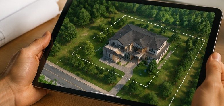
Interestingly, the term lot vision has another meaning in the homebuilding industry. Schumacher Homes uses a mapping tool with the same name to help homeowners visualize custom house designs on their actual land. While both systems serve different industries, they share one goal: turning physical spaces into smarter, easier-to-manage digital environments.
What Is Lot Vision and Why Is It Becoming Important?
Lot Vision refers to technology that uses digital mapping, location tracking, and visualization tools to solve problems caused by large physical spaces.
In automotive auctions, thousands of vehicles may sit across hundreds of acres. Finding one specific car manually can waste employee time, delay transportation, and increase operational costs. Lot Vision solves this by connecting vehicles to a digital location system.
In residential construction, the challenge is different. Homeowners often struggle to imagine how a house design will fit on their land. A mapping-based Lot Vision platform allows them to preview placement before construction begins.
Both applications show how digital tools are changing traditional industries by reducing uncertainty.
How Does Manheim Lot Vision Help Auto Dealers Find Vehicles Faster?
Manheim’s LotVision system was designed for wholesale vehicle auctions, where speed and accuracy directly affect business operations.
The system uses wireless tracking devices connected to vehicles through an OBD port or placed on the steering wheel. These devices communicate location information and allow users to see vehicles on a digital auction map.
Instead of searching row after row, dealers can enter information such as:
- Vehicle Identification Number (VIN)
- Work Order number
- Vehicle details
The system then displays where the vehicle is located within the auction facility.
According to Manheim, the technology can identify vehicle positions within approximately a 10-foot radius, helping dealers, transport companies, and auction employees reduce time spent searching for inventory.
For large-scale vehicle operations, this is more than convenience. Faster vehicle movement can improve delivery schedules and reduce labor costs.
What Extra Features Does Manheim Lot Vision Offer?
Many people assume Lot Vision only provides location tracking, but the system has expanded beyond basic mapping.
One important feature is access to vehicle diagnostic information. The platform can report diagnostic trouble codes (DTCs), allowing users to identify potential vehicle issues remotely.
For example, a transporter preparing a vehicle shipment may discover that a vehicle has an active warning code before it leaves the auction property.
This creates several practical benefits:
- Faster vehicle preparation
- Better inventory decisions
- Reduced surprises during transportation
- Improved communication between buyers and sellers
The ability to combine location data with vehicle information makes the system more valuable than a simple GPS tracker.
How Does the Lot Vision Process Work at an Auto Auction?
For dealers unfamiliar with the technology, the process is fairly straightforward.
Step 1: Vehicle tracking begins
A tracking device is assigned to a vehicle when it enters the auction system. The device connects the physical vehicle with its digital record.
Step 2: The vehicle appears on a digital map
The system creates a virtual representation of the auction lot. Users can view where vehicles are parked instead of relying only on printed records.
Step 3: Search using vehicle information
A dealer searches using a VIN or work order number. The platform identifies the vehicle location and provides directions within the property.
Step 4: Confirm and move the vehicle
Employees can quickly locate, inspect, transport, or prepare the vehicle for delivery.
This workflow is especially useful during busy auction periods when thousands of vehicles may be processed.
What Is Schumacher Homes Lot Vision Used For?
The homebuilding version of Lot Vision focuses on visualization rather than vehicle tracking.
Schumacher Homes created a mapping tool that allows customers to place a custom home design on their own property using satellite imagery.
A homeowner can typically:
- Enter a property address or parcel information.
- View the land digitally.
- Position a selected home design.
- Evaluate placement before construction.
This helps answer important questions early:
- Will the house fit the property?
- Where should the driveway go?
- How much yard space remains?
- Does the home orientation make sense?
Planning mistakes can become expensive once construction begins, so early visualization can help homeowners make better choices.
The Federal Emergency Management Agency (FEMA) also highlights the importance of understanding land conditions and property risks during building decisions. Homeowners can review resources from FEMA.gov when considering location-related factors.
Lot Vision vs Traditional Methods: What Is the Difference?
| Traditional Approach | Lot Vision Approach |
| Manual searching or paper records | Digital maps and searchable data |
| Time-consuming location checks | Faster identification |
| Limited visibility before decisions | Real-time visualization |
| Higher chance of mistakes | Better planning accuracy |
The biggest advantage is information access. Instead of guessing where something is or how it will fit, users can see digital information before taking action.
Why Does Lot Vision Matter in Real Life?
Technology like this addresses a common problem: physical spaces are difficult for humans to manage at large scale.
A vehicle auction lot can be larger than many people expect, while a residential property can have complicated boundaries, terrain, and placement limitations.
Digital mapping tools help people make decisions based on accurate information rather than assumptions.
For businesses, this can mean improved efficiency. For homeowners, it can mean fewer costly construction changes.
The National Institute of Standards and Technology (NIST) explains how digital technologies and data-driven systems improve efficiency across industries. More information about technology standards can be found at NIST.gov.
A Practical Checklist Before Using a Digital Lot Mapping Tool
Whether you are managing vehicles or planning a home, these checks can improve results:
For vehicle tracking
- Confirm the correct VIN or work order.
- Check that the tracking device is properly assigned.
- Verify the vehicle location before dispatch.
- Review available diagnostic information.
- Update records after movement.
For property visualization
- Confirm property boundaries.
- Check local building requirements.
- Review access points such as roads and driveways.
- Consider sunlight direction and drainage.
- Compare multiple home placements.
Digital tools work best when users combine technology with accurate real-world information.
Common Misunderstandings About Lot Vision
One common mistake is assuming Lot Vision is a single universal product. The name applies to different tools depending on the industry.
Manheim LotVision is focused on vehicle operations, while Schumacher Homes Lot Vision supports residential planning.
Another misconception is that digital visualization replaces professional judgment. These tools improve decision-making, but inspections, regulations, and expert advice remain important.
A map can show possibilities, but it cannot replace physical evaluation.
Frequently Asked Questions About Lot Vision
1. What is Lot Vision mainly used for?
Lot Vision is mainly used for vehicle tracking at Manheim auctions and property visualization through Schumacher Homes.
2. Can anyone access Manheim Lot Vision?
No. It is designed primarily for authorized dealers, transporters, and auction users.
3. Does Lot Vision track vehicle health?
Manheim’s system can provide diagnostic trouble code information for supported vehicles.
4. Can homeowners use Lot Vision before building?
Yes. Schumacher Homes uses it to help customers visualize home placement on their property.
Final Thoughts: Why Digital Lot Mapping Is the Future
The most interesting thing about Lot Vision is that it solves two very different problems with the same idea: making physical spaces easier to understand.
A dealer needs to find a vehicle quickly. A homeowner needs to imagine a future house before construction begins. Both require better visibility.
As industries continue adopting digital maps, tracking systems, and visualization technology, tools like Lot Vision will become increasingly valuable. The lesson is simple: when spaces become complicated, better information creates better decisions.